TRANSLATE THIS GUIDESelect your language
Automatic translation
SELECTED GUIDE

Steve Koffman’s Complete Southwest Florida Real Estate Guide

The complete topic is displayed directly below.

← Back to Directory
WHEN IT IS YOUR HOME, EXPERIENCE MATTERS!239-229-6152
FROM REDFISH POINT TO WATERFRONT WONDERLAND

The history of Cape Coral, Florida

Cape Coral’s identity was shaped by an ancient estuary, Indigenous people, ambitious land development, hundreds of miles of canals, civic determination, explosive growth and repeated adaptation to water.

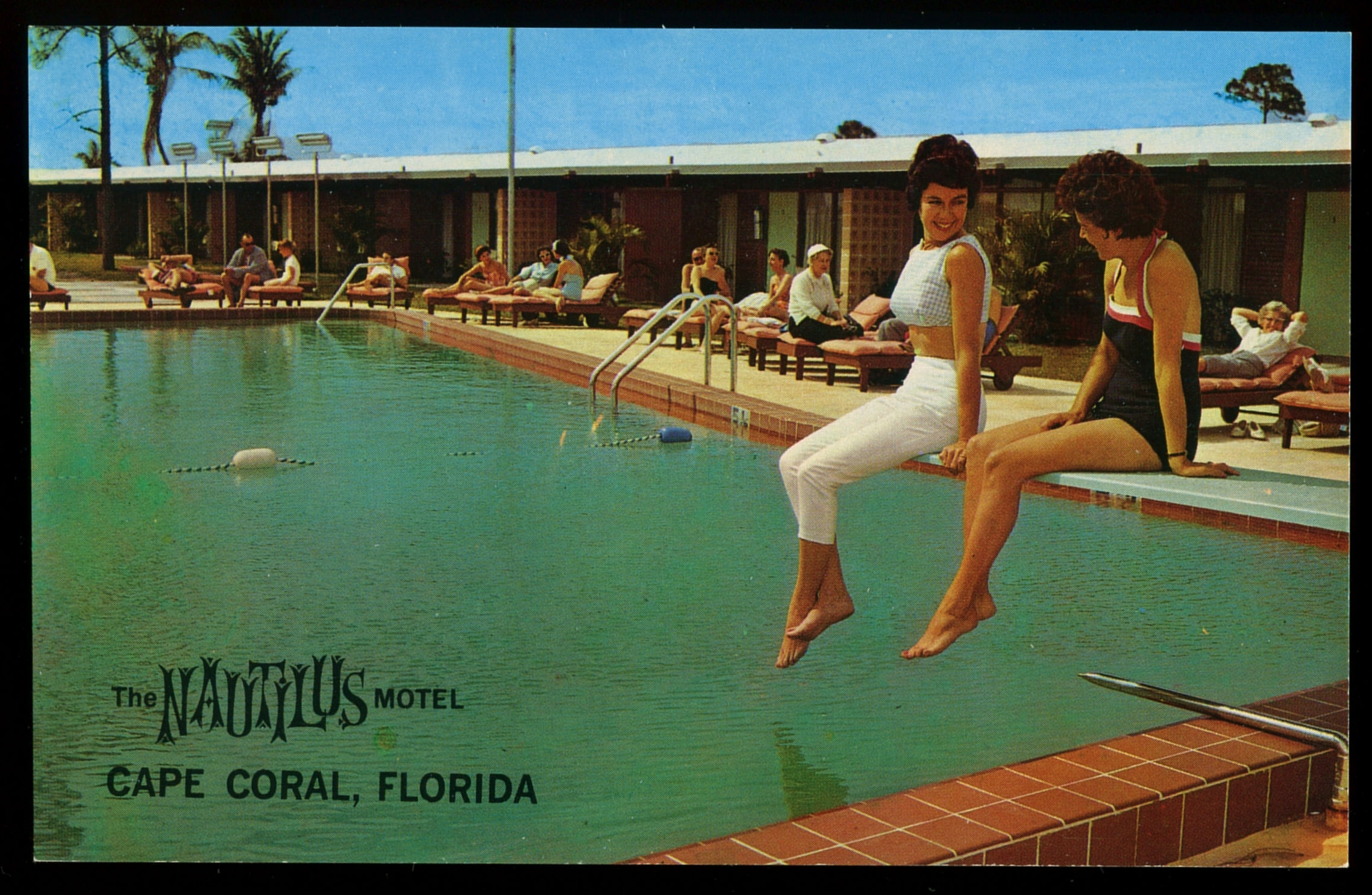
Historic Cape Coral Nautilus motel postcard
Historic Cape Coral
A WATERFRONT CITY MADE IN LAYERS

Understanding the past helps explain today’s property map.

The canals, wide residential grid, scattered commercial centers, bridges, utilities, flood exposure and environmental debates that shape Cape Coral real estate today all trace back to decisions made during its creation.

This guide is a concise, comprehensive timeline—not a substitute for the Museum’s archives. Facts are grounded primarily in the Cape Coral Museum of History, City of Cape Coral, Lee County and U.S. Census Bureau sources linked below.

CAPE CORAL THROUGH TIME

A chronological history

  1. Before European contact

    People lived in Florida at least 12,000 years ago. By about 800 CE, the Calusa controlled a powerful coastal society around the Caloosahatchee, Pine Island, Sanibel and neighboring islands. Their economy and political influence were inseparable from the estuary.

  2. 1500s–1800s

    Spanish expeditions encountered the Calusa in the early 1500s, but never established lasting control over their domain. Disease, warfare and colonial disruption changed the region. Seminole and Miccosukee people later became central to South Florida’s Indigenous history.

  3. 1800s–1950s

    Long before suburban development, the peninsula supported homesteads, cattle, logging and lumber operations, citrus, gladiolus farming, fishing and hunting. Much of the land passed among cattle and timber companies.

  4. 1956–1958

    Jack and Leonard Rosen purchased the 1,724-acre Redfish Point tract for $678,000. Their company—later Gulf American Land Corporation—opened a sales office and began selling Cape Coral homesites in January 1958.

  5. Late 1950s–1960s

    Dredging created canals, lakes and yacht basins while excavated material raised homesites and formed the city’s distinctive waterfront grid. National advertising, low-down-payment installment plans and fly-in sales tours marketed a ‘Waterfront Wonderland’ to veterans, retirees and northern buyers.

  6. 1962–1964

    Amenities helped turn a land promotion into a community. The Rosen Building dates to 1962. The Cape Coral Bridge opened in 1964, giving residents a direct connection to Fort Myers, and Cape Coral Gardens opened the same year with roses, model homes and its famous Waltzing Waters display.

  7. 1965–1970

    Cape Coral gained churches, a post office, a newspaper, shops, medical services, fire protection and civic organizations. As Gulf American faced regulatory scrutiny and residents debated responsibility for local services, the campaign for self-government intensified. Cape Coral Gardens closed in August 1970.

  8. 1970

    Residents approved incorporation on August 11 by a vote of 2,067 to 1,798. Seven council members were elected, and the first City Council meeting was held December 3. The new city began with 10,193 residents and inherited both extensive platted land and major infrastructure challenges.

  9. 1970s–1980s

    Cape Coral professionalized police and fire services, built schools and municipal facilities, and expanded water and utility systems. Cape Coral Hospital opened in 1977; Coralwood Mall followed in 1980. The Historical Society incorporated in 1980, and the museum opened in the Rosen Building in 1987.

  10. 1990s–2010s

    Rapid population growth continued. The Midpoint Memorial Bridge opened in 1997, creating another direct river crossing. The city expanded reverse-osmosis water treatment, utilities and public services while confronting the long-term environmental and financial consequences of its original development pattern. Hurricanes Charley in 2004 and Irma in 2017 tested the community.

  11. 2020–today

    The 2020 Census counted 194,016 residents. Hurricane Ian made landfall on September 28, 2022 and began another defining era of repair, flood-risk awareness and waterfront rebuilding. The Census Bureau estimated 236,264 residents in 2025—evidence that Cape Coral’s story remains one of extraordinary growth and reinvention.

REGIONAL INFRASTRUCTURE

RSW is building the region’s next airport era

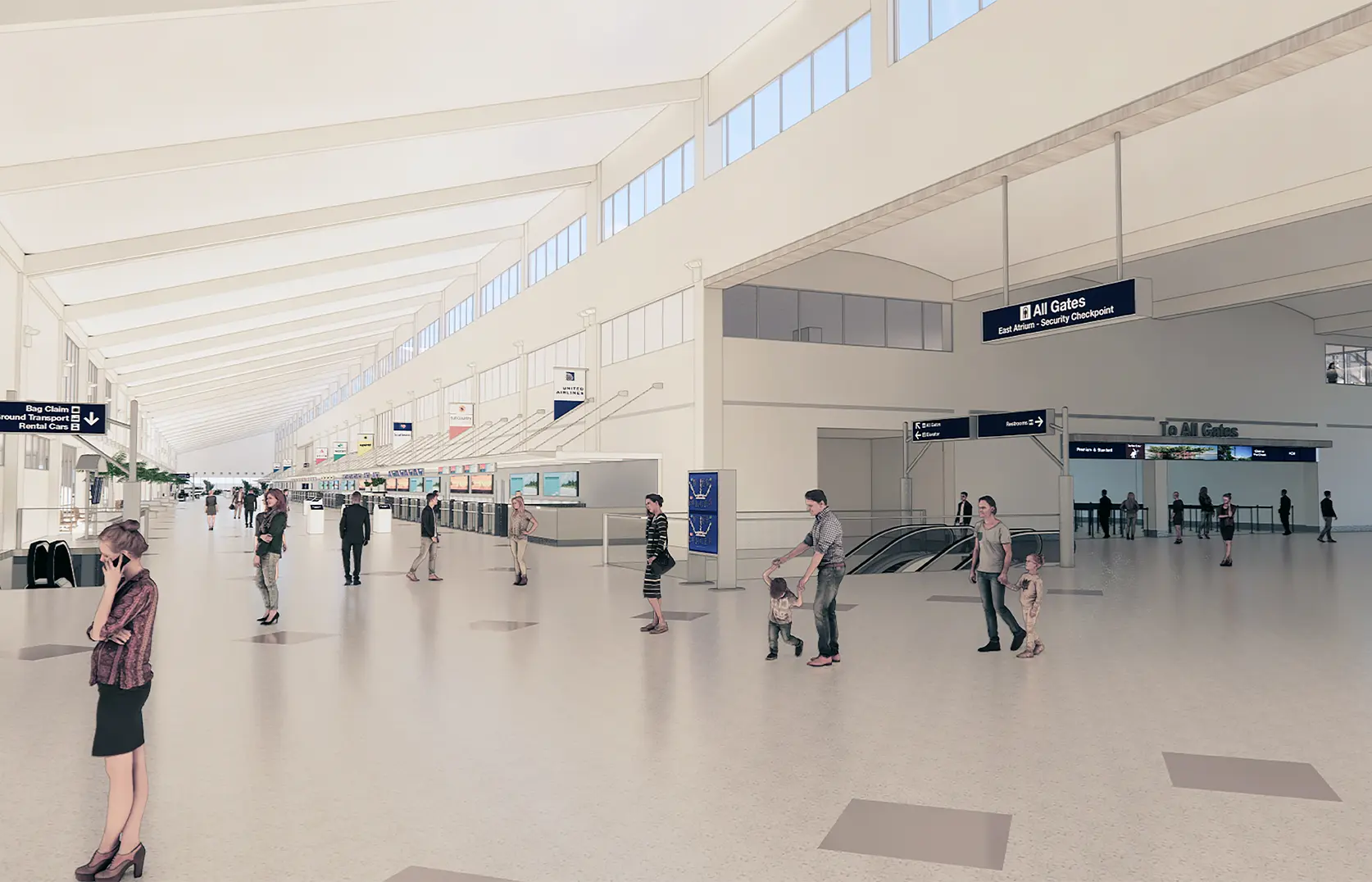
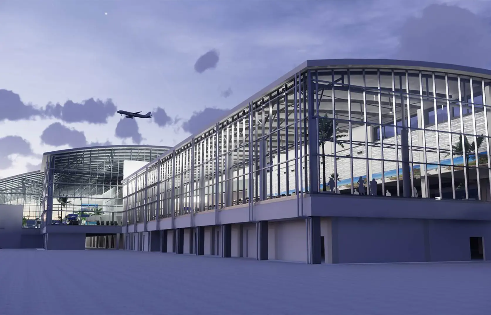
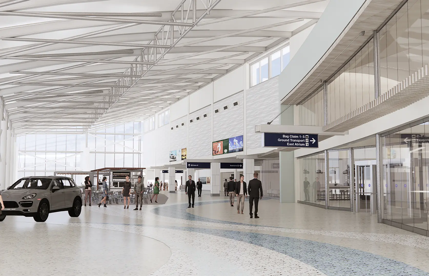
Southwest Florida International Airport is advancing a two-phase terminal expansion. Phase 1 consolidates security into a 16-lane checkpoint while remodeling more than 164,000 square feet and adding 117,000 square feet of walkways and concession space. Phase 2 expands all three terminal levels, adds ticketing and baggage-claim capacity, and creates Concourse E with 14 initial gates and infrastructure for 19.

Official project details ↗Local-TV story ↗
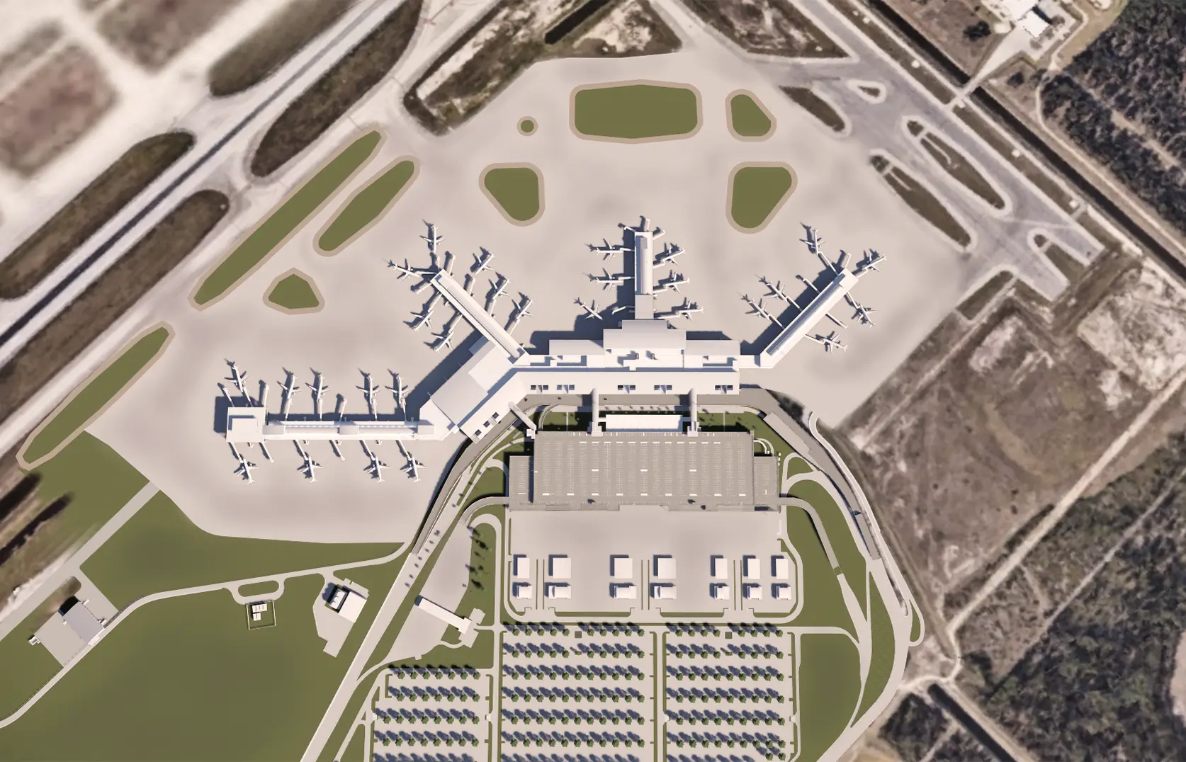
Phase 2 aerial view
Phase 2 aerial viewAerial rendering of the expanded terminal and new Concourse E serving Southwest Florida International Airport.Rendering: Lee County Port Authority
Expanded ticketing and bag claim
Expanded ticketing and bag claimPhase 2 rendering of the larger terminal, including new ticketing and baggage-claim space.Rendering: Lee County Port Authority
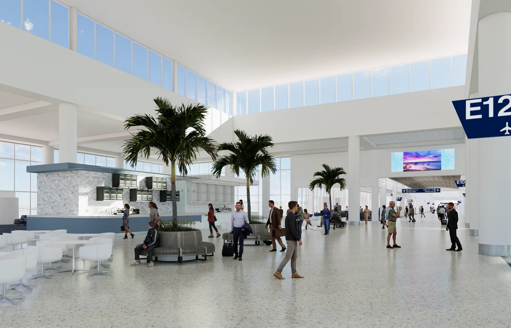
New Concourse E gates
New Concourse E gatesConcourse E is planned with 14 operating gates and infrastructure that can support 19 gates in the future.Rendering: Lee County Port Authority
Centralized security checkpoint
Centralized security checkpointPhase 1 rendering of the consolidated 16-lane TSA checkpoint and expanded passenger circulation.Rendering: Lee County Port Authority
Terminal exterior improvements
Terminal exterior improvementsExterior rendering showing the more open terminal frontage and updated passenger approach.Rendering: Lee County Port Authority
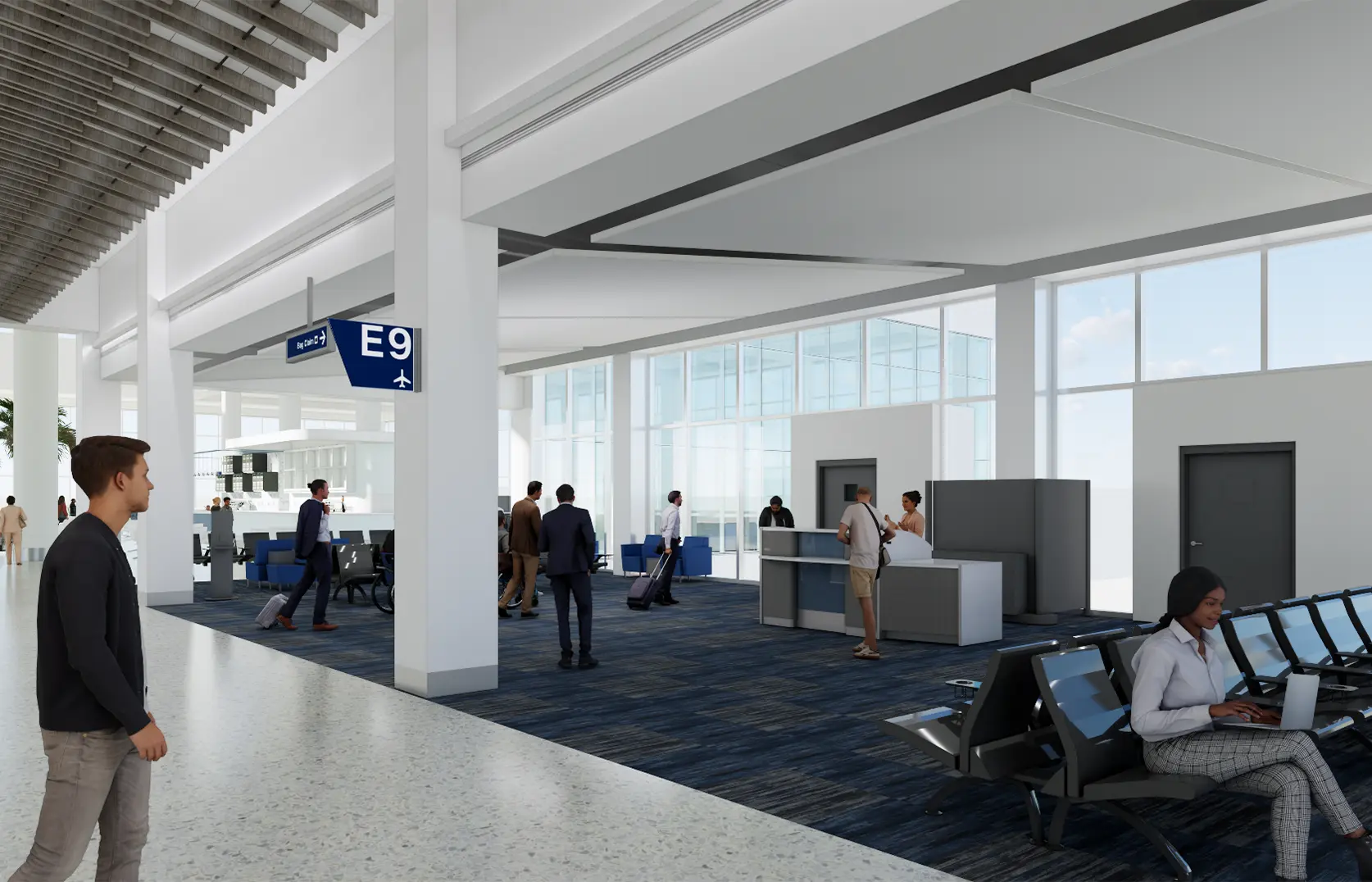
More passenger amenities
More passenger amenitiesPhase 1 rendering of added seating, walkways, concessions and passenger spaces inside the terminal.Rendering: Lee County Port Authority
NORTH CAPE CORAL

New development is planned south of Yucca Pens Preserve

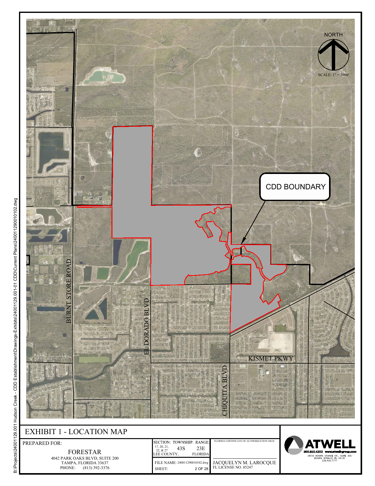
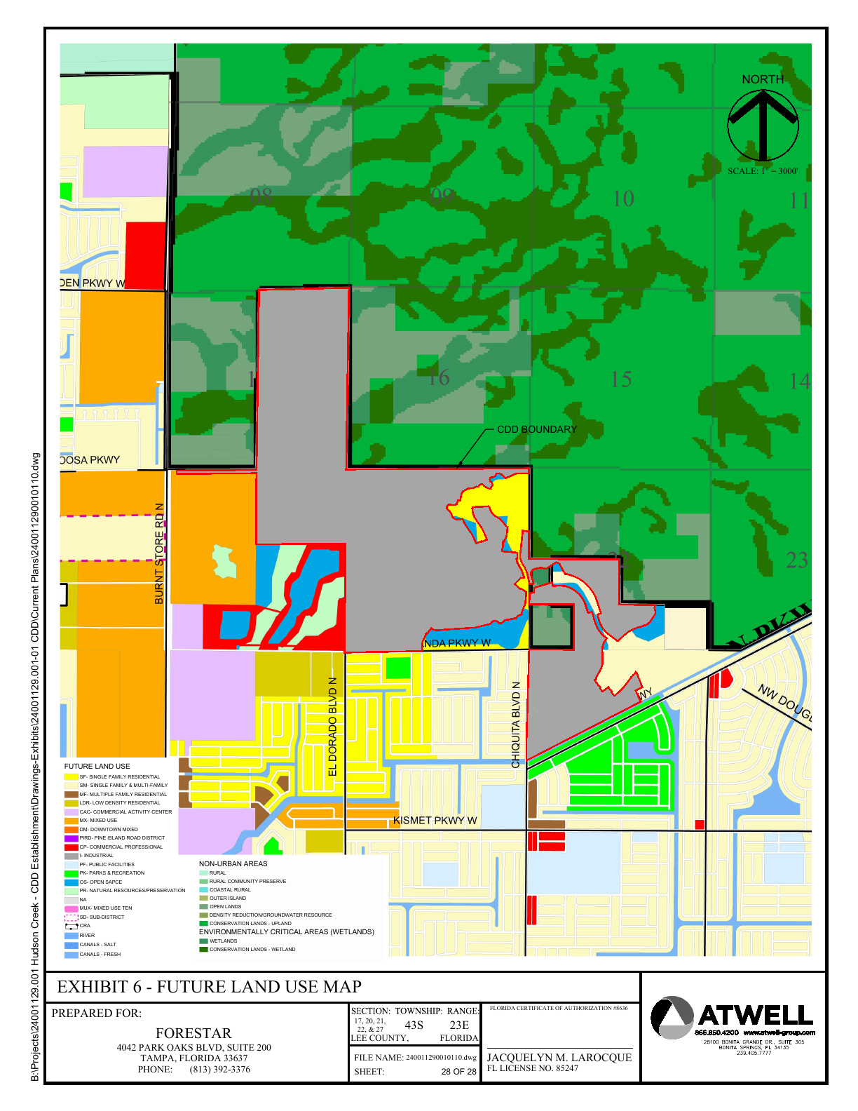
Cape Coral City Council approved the Star Farms at Cape Coral Community Development District in July 2026. Official district documents cover approximately 1,279.549 acres east of Burnt Store Road, south of Yucca Pens Preserve, north of Wilmington Parkway and west of Andalusia Boulevard. The petition anticipates about 2,500 homes and identifies a 2026–2031 infrastructure window, although final plans, permits and timing can change.

Location matters: the proposed district is adjacent to and south of Yucca Pens Preserve; the official documents do not describe development inside the named preserve.

Official district documents ↗City Council approval ↗Cape Coral Breeze coverage ↗
Official Star Farms location map
Official Star Farms location mapThe official petition’s full location exhibit. Gray shading marks the 1,279.549-acre district east of Burnt Store Road and south of Yucca Pens Preserve.Source: official Star Farms at Cape Coral CDD petition
Official future land-use map
Official future land-use mapThe complete future land-use exhibit shows the district boundary, nearby North Cape neighborhoods and conservation land to the north.Source: official Star Farms at Cape Coral CDD petition
WHY THE HISTORY MATTERS TO BUYERS

The canal system is both Cape Coral’s signature and its inheritance.

Canals supplied fill to raise land, drained a low-lying peninsula and created the waterfront-lot inventory that drove sales. The result is not one uniform boating network: saltwater and freshwater systems, bridges, weirs, locks, route lengths and water depths vary by neighborhood.

Original platting also left the city with long-term utility, transportation, water-quality and flood-management challenges. For a buyer, history becomes due diligence: seawall age, finished-floor elevation, flood zone, assessments, utility availability and boat access can affect value and ownership cost.

A balanced history

Cape Coral’s growth created opportunity and a celebrated waterfront lifestyle, while converting wetlands and altering natural drainage. Both stories matter when evaluating the city’s future.

WATCH THE ARCHIVE

Public Cape Coral history videos

These videos are streamed from their publishers. Titles and availability may change.

Early Promotional Video of Cape Coral, Part 1

A period land-sales film showing how the new community was marketed.

Cape Coral: Dreamers & Schemers

A documentary treatment of the people, promotion and development behind the city.

Ask an Expert: History of Cape Coral

A public conversation with Cape Coral Historical Museum leadership.

PHOTOS, OBJECTS & ORIGINAL RECORDS

Explore the official collections

The Museum is the City’s official historical repository, with thousands of additional photographs, documents and artifacts available for public research.

PERSONAL WATERFRONT HELP

Let Cape Coral’s history guide your property search

Ask Steve how a neighborhood’s era, canal system, bridge route, seawall, elevation and infrastructure can affect your buying decision.