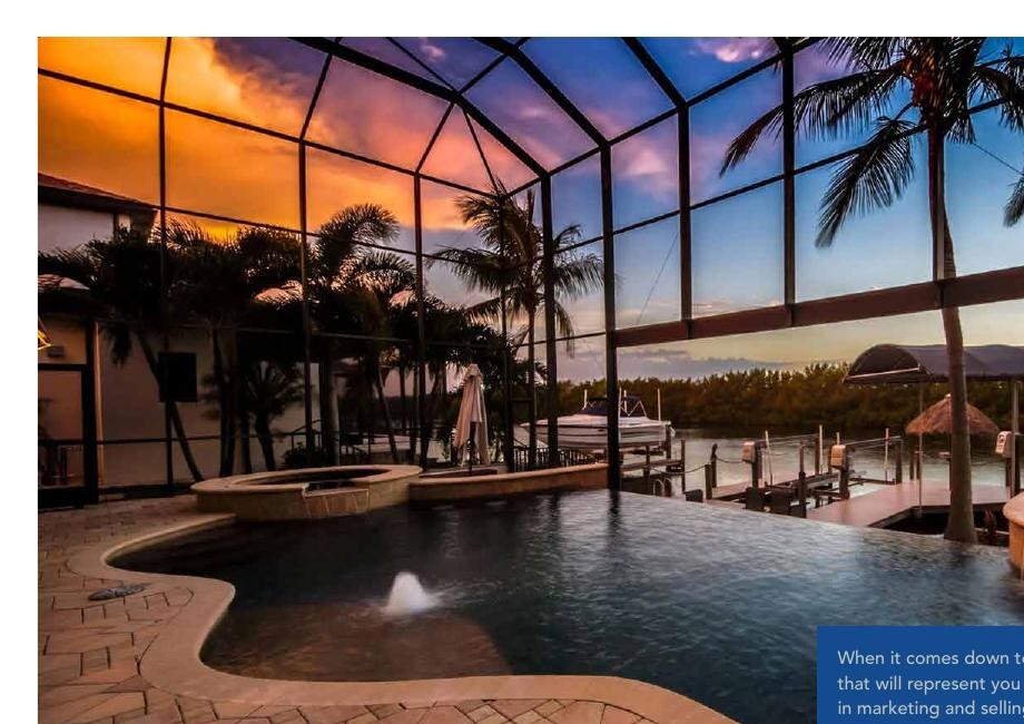
Direct sailboat access
No fixed bridges between the property and open water. Best for tall boats and sailboats; often commands a premium.
Higher acquisition cost; route length, channel depth, tide and lock conditions can still matter.
The complete topic is displayed directly below.
The right property begins with how you plan to use the water. Compare access, bridge limits, maintenance, flood exposure and resale before falling in love with the view.

These categories are a starting point. Individual routes, canals, docks, lifts and restrictions must be checked property by property.
No fixed bridges between the property and open water. Best for tall boats and sailboats; often commands a premium.
Higher acquisition cost; route length, channel depth, tide and lock conditions can still matter.
Saltwater boating access at a broader range of prices.
Your boat’s true air draft must fit every bridge on the route—with a safety margin for tide, load and antennas.
Wide water, privacy, sunsets and nature views along the western edge.
Routes may be longer; shallow water, manatee zones and environmental protections affect use.
Expansive views and fast access to the Caloosahatchee.
Greater wave, wake, wind and storm exposure; seawall, dock and insurance diligence is critical.
Fishing, kayaking and attractive water views—often at a lower entry price.
Weirs separate these systems from saltwater. There is no boat route to the river or Gulf.
Amenities and possible deeded or leased slips with less individual exterior maintenance.
Review slip dimensions, assignment rights, HOA rules, reserves and assessments.
No private seawall expense and often a lower purchase price.
No backyard dock; storage, launch access and marina costs replace that convenience.
A common Cape Coral seawall uses interlocking precast concrete panels, a reinforced concrete cap and tieback rods connected to buried anchors. Drainage and stable backfill are as important as the visible face. Vinyl or composite systems are also used.
Concrete seawalls can serve 30–50+ years, and some much longer, when design, soils, tiebacks, drainage and maintenance are favorable. Salt exposure, corrosion, storms and boat wake can shorten service life. Have a qualified marine contractor inspect the wall.
An Elevation Certificate records surveyed building elevations and connects them to the FEMA map, base flood elevation (BFE) and vertical datum. It is not an appraisal, an insurance quote or a document that removes a property from a flood zone.
Confirm the map panel and effective date, flood zone, BFE, lowest-floor or first-floor height, adjacent grade, foundation/enclosure details and elevations of building equipment.
Compare the living floor with the current BFE and local freeboard requirement. Ask an insurance professional to quote the exact property—with and without certificate data—before the inspection period expires.
Elevation can influence expected flood damage, insurance cost, renovation flexibility, lender comfort and the future buyer pool. Those factors can affect marketability and value, but no elevation creates a guaranteed premium or sale-price adjustment.
Start with the statewide search for any Lee County address, or choose the city, town, village or unincorporated County portal that maintains the property’s building records.
Best first search for any address in Lee County. It includes Elevation Certificates submitted to the State beginning in 2023 and other records available through the statewide system.
Important: No result does not mean no certificate exists. Older, paper-only, differently addressed or privately commissioned records may require a request to the local floodplain or building office. Verify that any document matches the correct structure, parcel, date and vertical datum.
Official starting points: Florida Division of Emergency Management certificate-search guidance · FEMA: Understanding Elevation Certificates · FEMA Map Service Center
For a below-compliant building in the Special Flood Hazard Area, if the cost of improvements or the cost to restore damage equals or exceeds 50% of the structure’s market value before work—or immediately before damage—the building generally must be brought into current floodplain compliance. Land value is excluded.
Repair estimates must reflect the work needed to return the building to its before-damage condition, and local officials make the formal determination. Before signing a renovation contract, ask the correct city or county floodplain office for a written, property-specific review.
project or repair cost ÷ pre-work structure value

FEMA supplies the minimum framework, while each participating city or county administers its adopted ordinance. The history below explains why two similar homes in different jurisdictions may have accumulated past permits differently.
Past: Cape Coral added repair and improvement costs from the prior five years.
Change: Ordinance 96-22 removed the local cumulative-impact language after Hurricane Ian. The base 50% test and flood-code compliance requirements remain.
Cape Coral ordinance summary ↗Past: The County used a five-year cumulative period for most properties.
Change: Ordinance 22-30 moved most properties to a permit-by-permit approach; FEMA-designated repetitive-loss properties retained a 12-month cumulative review.
Lee County Ordinance 22-30 ↗Past and present guidance: The Town’s post-Ian FAQ says its ordinance does not include a general five-year or similar cumulative clause.
The 50% threshold still applies to the full cost of a substantial improvement or restoring substantial damage.
Town 50% Rule guidance ↗Past: Sanibel used a five-year cumulative period and a lifetime floor-area restriction; City records say the look-back had previously been seven years.
Change: The City moved away from those higher local standards in 2016. Its current packet applies the 50% project or repair test and requires supporting valuation and cost documents.
Sanibel building forms and FEMA packet ↗A Letter of Map Revision Based on Fill is FEMA’s determination that a structure or parcel raised with fill meets the technical criteria to be removed from the mapped Special Flood Hazard Area. In Cape Coral, it is the most common map-change request because fill was widely used during development.
A Letter of Map Amendment is generally used when surveyed natural ground or the structure’s lowest adjacent grade is already high enough and the effective map placement may be incorrect.
FEMA requires surveyed elevations and additional technical documents. Cape Coral says a City-signed Community Acknowledgment Form is part of the application; FEMA charges a review fee.
A Letter of Map Revision can formally change effective floodplain boundaries, BFEs or floodways, often using updated engineering across a larger area.
Official references: Cape Coral LOMA / LOMR-F process · FEMA: LOMA and LOMR-F · FEMA: LOMR and CLOMR
Send Steve the address and your boat details. He can help you evaluate access, bridges, seawall, elevation and due-diligence questions before you commit.